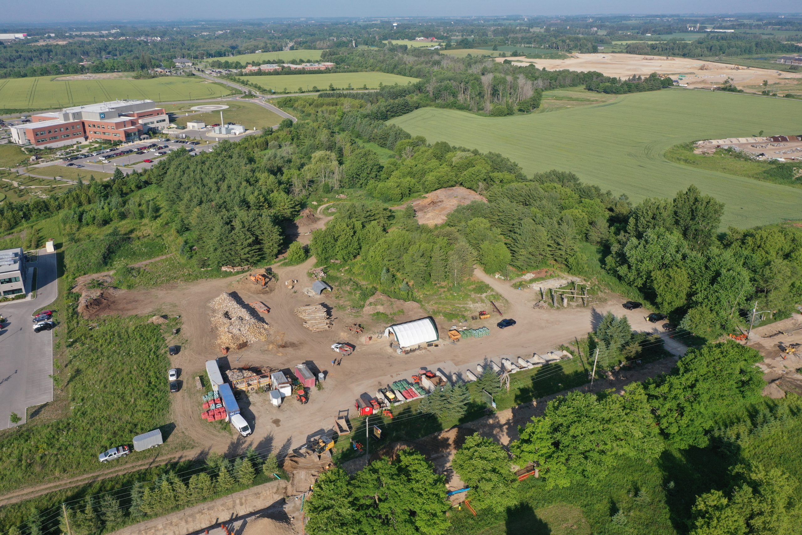
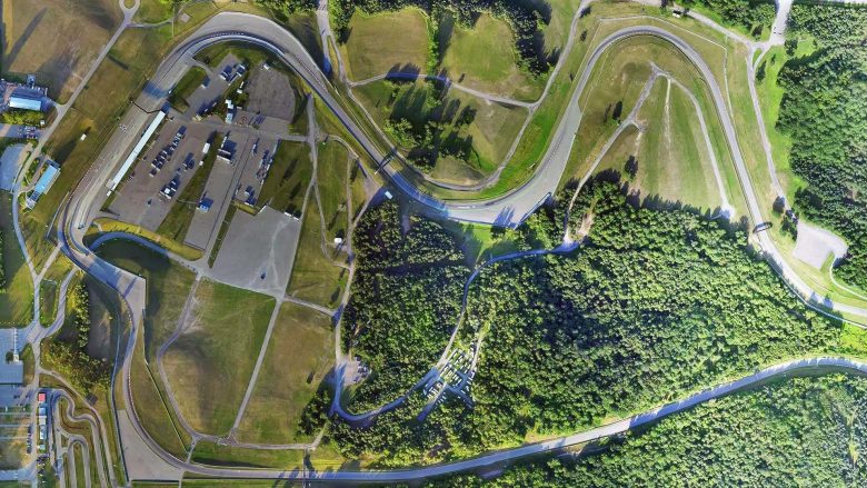
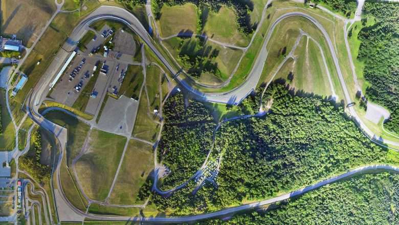
Aerial Survey Fergus, Ontario: Photo and LiDAR Data Collection via Drone
UAV Ontario, a leading drone services provider, recently conducted an advanced drone survey for a property located in Fergus, Ontario. Leveraging cutting-edge technology, the team employed a DJI Matrice 300 (M300) drone equipped with both the DJI P1 and L1 cameras to capture highly accurate and detailed aerial imagery.
The project aimed to provide a comprehensive survey of the property’s topography, ensuring precision and efficiency. To achieve this, UAV Ontario employed ground control points (GCPs) collected using a Trimble ground station, which integrated seamlessly with the CAN-NET Real-Time Kinematic (RTK) network. This integration allowed for real-time correction of the drone’s positioning, enhancing the accuracy of the survey data.
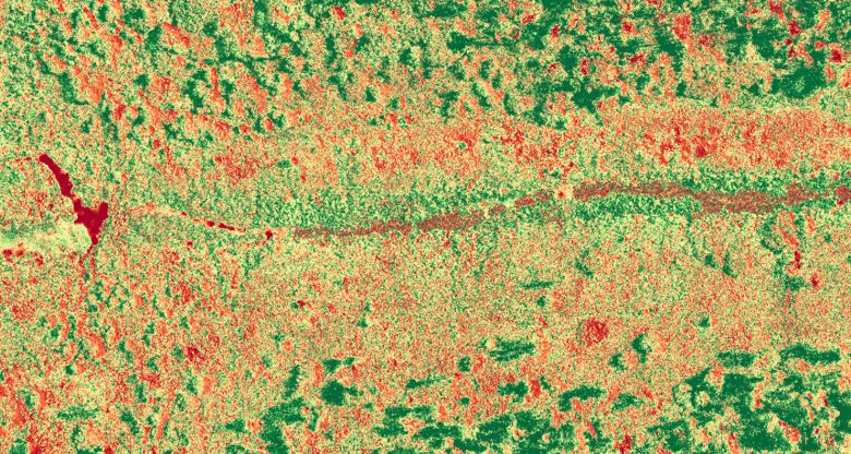
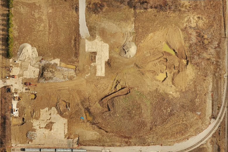
Following the data collection phase, UAV Ontario utilized DJI Terra software for post-processing. This software is specifically designed for photogrammetry and remote sensing applications, enabling the team to stitch together the images captured by the P1 and L1 cameras to create a high-resolution orthomosaic and point cloud.
The point cloud data generated through DJI Terra was then employed to create topographic contours. This involved the use of AutoCAD, a renowned software for computer-aided design and drafting. UAV Ontario’s skilled team utilized AutoCAD to analyze the point cloud data and extract valuable information to generate precise topographic contours of the property.
The integration of the DJI M300 drone, P1 and L1 cameras, Trimble ground station, CAN-NET RTK network, DJI Terra software, and AutoCAD allowed UAV Ontario to deliver a comprehensive survey package to the client. The resulting topographic contours provided invaluable insights for future development and planning on the property in Fergus, Ontario.
UAV Ontario’s successful execution of this drone survey project showcased the power of combining cutting-edge drone technology, RTK positioning, advanced photogrammetry software, and CAD tools to provide accurate and actionable survey data for a variety of applications.